
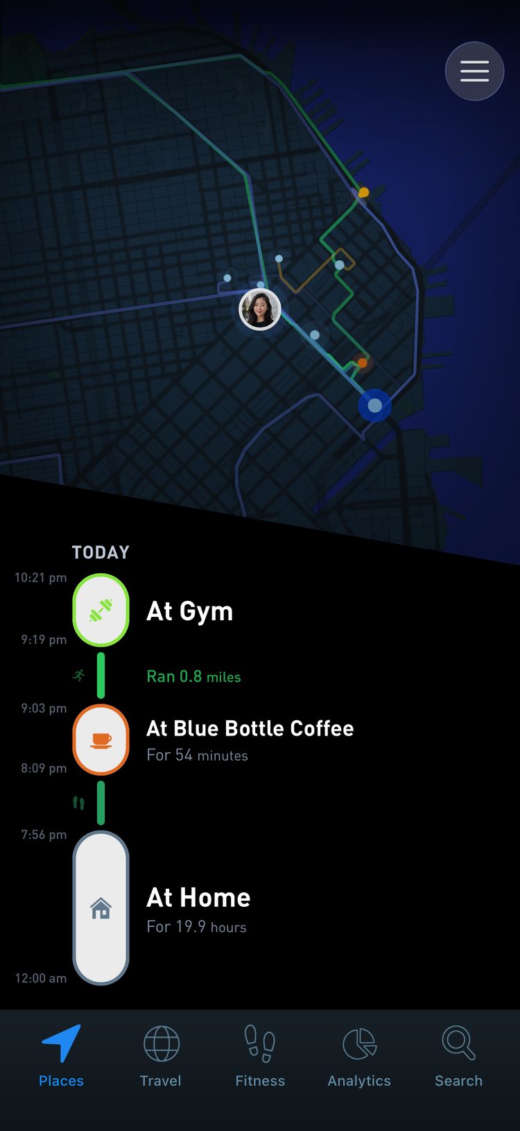
Places builds a detailed timeline of your life in the background. Most location apps leave you with a few dots on a map, or ask you to check in by hand. Places turns raw GPS points into a story: where you were, what it was, and how it fits into your life.
Identifying your places is how you teach it your routine, your travels and your history. This guide covers how that works and how to get it right in your first week.
How automatic detection works
When you stop somewhere, the app sees a cluster of GPS points in one area and creates a new place. At any one location there can be many venues stacked together: a park, a restaurant, the cafe next door, an office upstairs. Even with precise GPS it is not always obvious which one you were in.
That is why a new spot first appears as Unidentified. You confirm the exact place once, and the app takes it from there.
The Foursquare database
To work out what is nearby, Places uses the Foursquare location database, which covers millions of venues around the world. Tap an unidentified place and you get a list of nearby options, and the right one is usually at or near the top.
In dense areas like downtown New York there can be thousands of venues on a single block, so sometimes you will type a few letters to search. Most restaurants, cafes, gyms and businesses you visit regularly are already in the database.
Your first week is training
For the first few days almost everything is unidentified. Spend a couple of minutes each day tagging where you went. Once you have identified a place, the app knows it. On your next visit it combines distance, how often you go, when you were last there and other signals to recognize it on its own.
After that short training period, most of your daily routine is fully automatic.
Why doing this early matters
If weeks or months go by without tagging, the unidentified places pile up. Remembering what a stop was a year ago is much harder than remembering yesterday. Review your new places every day or two, especially during your first week.
Day to day, and on the road
Day to day, live your life while the app runs in the background. Once a day, or every few days, open it, let it sync, and tag anything new.
A new city, a new country or a road trip brings a lot of new places at once. On trips it helps to identify them at the end of each day, while the details are still fresh.
When a place is not on the list
A small business, a new venue or an obscure spot may not show up. You have two options:
- Search with a broader term, like “Coffee Shop” or the name of the neighborhood.
- Create a custom place with your own name and icon.
Naming Home
Home is one of your most important places, and most residential buildings are not public venues. Search for the building name if it exists in the database, or create a custom place called “Home”.
Over the years you may live in more than one home, so it can help to be a little more specific: “Alamo Square Apartment”, “Greenpoint Loft”, “Kyoto House”. Pick an icon that stands out on your map.
Names and privacy
Your raw data stays private in your account. The names you choose are different: if you share a screenshot or a report, they are visible in it. “Home” gives away far less than “123 Main Street Apartments, Unit 4F”. Choose the level of detail you are comfortable with.
Friends and other private places
Not everywhere you go is a business. A friend’s house might be “Alex’s house”, “Grandma’s place” or “Sunday D&D night”. If you prefer something more general, “Alex’s neighborhood” works too.
Give it an icon you will recognize at a glance, or delete the stop entirely if you would rather not log it.
Why this is worth it
An identified timeline turns coordinates into memories. “Lunch at your favorite ramen shop” instead of “Lat 35.002, Lon 135.754”. “Walk from home to the river” instead of disconnected dots.
Using phone geolocation tracking, mood check-ins and brain imaging, researchers found that on days when people moved through a wider variety of physical locations they reported more positive feelings, and the link was strongest in people with tighter coupling between the hippocampus and striatum. (Heller et al., Nature Neuroscience, 2020). Where you go shapes how you feel. A map of your days shows you when life has narrowed to the same few spots.
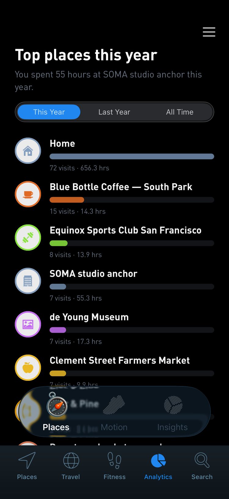
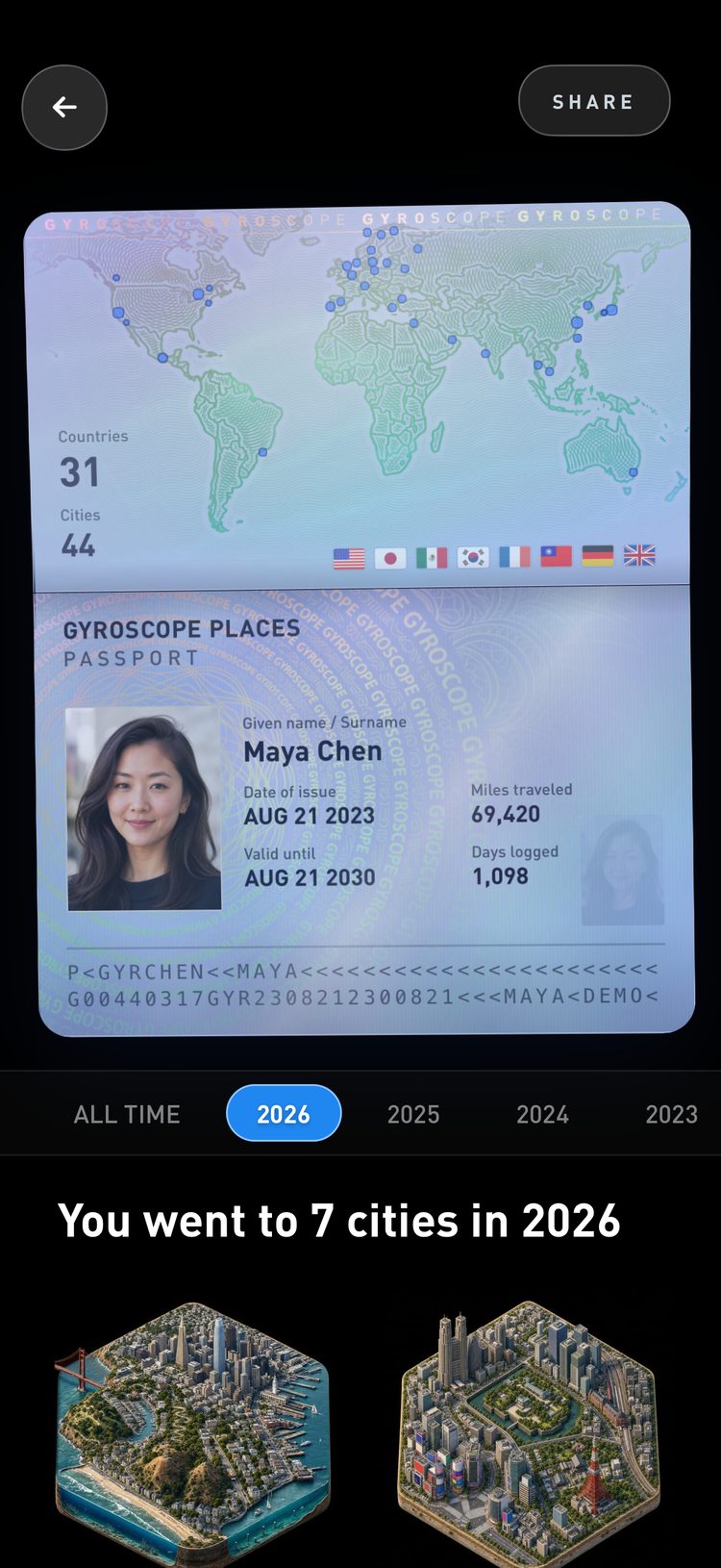
Once your places are tagged, the app can:
- Sort locations into categories like coffee shops, gyms, parks and airports.
- Show patterns over time, like your most visited cafes or how often you make it to the gym.
- Fill in your Global Passport with accurate cities, regions and countries.
- Detect flights by pairing the airports at each end.
In a survey of 19,806 adults in England, people who spent at least 120 minutes a week in nature had 59% higher odds of reporting good health and 23% higher odds of reporting high wellbeing than those who spent none, and it did not matter whether that was one long visit or several short ones. (White et al., Scientific Reports, 2019). Once your parks and trails are identified, that weekly total is something you can see.
The short version
Treat your first week as setup and review once a day. Always tag:
- Home
- Work, or your main workspace
- Favorite cafes and restaurants
- Gyms and other regular routines
- Hotels and airports while traveling
Delete the small stops that do not matter to you, and choose names that will still make sense when you look back years from now.